Course Description
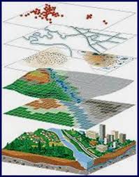
Introduction to the fundamentals of Geospatial Technology, including Geographic Information Systems (GIS), Global Positioning Systems (GPS), cartography, remote sensing, and spatial analysis through a series of hands-on computer-based exercises. Participants will learn how to utilize geospatial technology to address social and environmental issues. Access to Microsoft Windows on a PC or Mac is required..
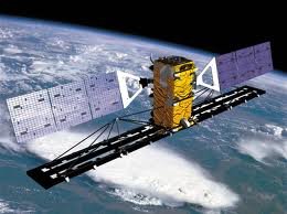
Remote sensing is the science of acquiring information about the Earth
using satellites. Scientists have developed sensors and cameras
that detect energy transmitted off of the surface of earth, technologists use
multiple platforms of technology to produce images that can be analyzed to
obtain useful information and statistics. Satellites are set in repetitive,
circular, sun-synchronous orbits at an altitude of around 800 km.
Being able to be
a part of this class has showed me how to enjoy and understand the use of
Drones and different applications to be able to manipulate data and statistics.
Being able to know that the military is using drones to not only help plot out
different plans of invasion but also to be able to keep our troops alive and
out of dangerous situations. They can also make out what the terrain is like
and what to expect before needed travel, they are also known ti be able to spot
human beings and other objects from 5-6 miles away.
One of the
tools we've learned in this class was how to enhance images;
enhancing images can help not only make the image as clear and legible as
they can and also make things more detailed than the original picture. The
military are in such an advantage having this feature opened up to them as they
can have clear images to be able to spot possible dangers and terrorists.
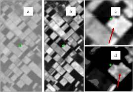
Another sensing tool we learned about is image interpretation. Some
things you’ll want to look for when interpreting an image are patterns,
shapes, textures, define the colors (including shadows), and find north.